

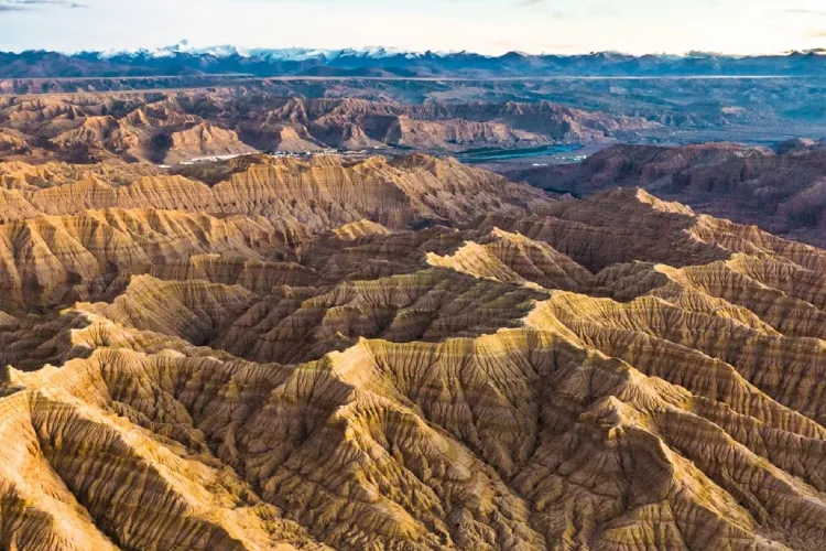
Indian scientists have devised an innovative method to study the movement of the Earth’s crust beneath the Tibetan Plateau using machine learning. This technique aids in predicting the motion of various parts of the Earth’s surface, which is significant for understanding natural phenomena like earthquakes and plate tectonics.
Typically, researchers rely on a network of GPS stations, known as Continuously Operating Reference Stations (CORS), to track the shifting of the Earth’s crust over time.
These stations continuously transmit data to offer detailed insights into ground movement. However, establishing these stations can be challenging, particularly in remote or rugged regions, due to the high costs and logistical difficulties involved. Consequently, there are often gaps in the data, making it difficult to get a comprehensive understanding of crustal movements.
To address this issue, scientists from the Wadia Institute of Himalayan Geology in India have turned to machine learning, a form of artificial intelligence that enables computers to learn from data and make predictions.
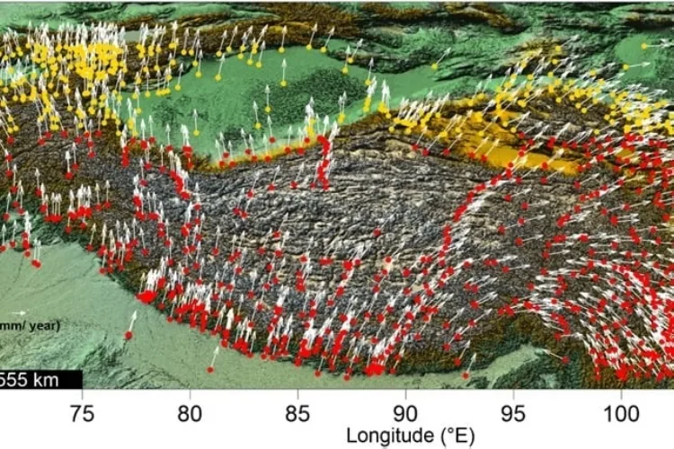
They employed various machine learning techniques, including support vector machines, decision trees, and Gaussian process regression. These methods enabled scientists to accurately predict the movement of the Earth’s crust in areas where setting up GPS stations is challenging.
The team analyzed data from 1,271 GPS stations across the Tibetan Plateau and surrounding regions. They used data from 892 of these stations to train their machine-learning models and data from the remaining 379 stations to test the accuracy of their predictions.
The results were remarkable as the machine learning models demonstrated a high level of accuracy in predicting crustal movements.

Published in the Journal of Asian Earth Sciences, the study highlights that machine learning can effectively forecast ground movements, even in regions where direct measurements are unavailable.
This approach is also more cost-effective, making it a valuable tool for scientists studying Earth’s dynamics and enhancing our understanding of natural processes.


Leave feedback about this